- Forschungsprojekte : /de/anwendungsorientierte-forschung/institute/itec/forschungsprojekte/
- Ausstattung : /de/anwendungsorientierte-forschung/institute/itec/ausstattung/
- Team : /de/anwendungsorientierte-forschung/institute/itec/team/
- Agenda : /de/anwendungsorientierte-forschung/institute/itec/agenda/
- News : /de/anwendungsorientierte-forschung/institute/itec/news/
- Ressourcen für Partnerunternehmen und -institutionen : /de/anwendungsorientierte-forschung/institute/itec/ressourcen-fur-partnerunternehmen-und-institutionen/
Modélisation physique de la propagation d'avalanches rocheuses ' Influence des caractéristiques de la masse au départ

Compared to other landslide movements, rock avalanches are catastrophic events involving a huge volume of material (more than 1 million cubic meters) and characterised by sudden failure, high propagation speed and very long travel distance. Due to these features, when an event occurs, the ability of persons to take evasive actions is almost reduced to zero and the risk of fatalities is considerable. Because of their mass, stabilisation measures are hardly possible to prevent the departure. Because of their energy, protection measures along their path will be swept away and totally ineffective. As a consequence, the only way to prevent fatalities and reduce risk is to delineate the zones of the territory that could be reached by such events.
Among the researches already carried out to explain the great mobility of rock avalanches, many authors have resorted to physical modelling to validate empirical, analytical or numerical formulations. More, as such experiments can be performed under well-controlled conditions and data can be gathered during the runout, physical modelling provides interesting information to gain insight into the possible mechanisms of propagation and deposition and to investigate the factors that can influence the mass runout.
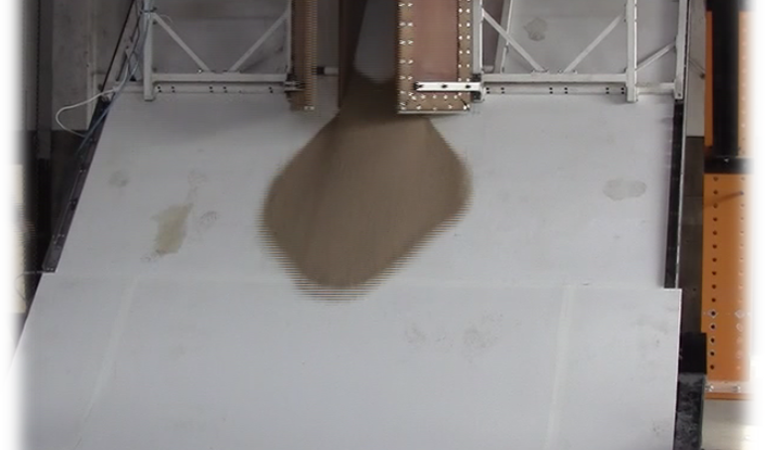
The research will be performed on a large physical model (4 x 6 m in size) allowing the release of dry granular materials on a slope ending with a horizontal accumulation area. Several testing parameters can be varied: material used (gravel, small bricks), release height, volume and release sequence (at once or at different times), inclination of the slope, surface roughness and morphology of the transition between the panels (sharp angular or curved). The foreseen experimental study will focus on assessing the influence of the initial geometry of the mass at start (width, height, inclination of the basal plane) on the propagation, lateral spreading and runout distance. It will take advantage of recent improvements to the releasing device and the measurement system. The former consists of a wood container with variable width and height and with a basal plane that can be inclined with respect to the dip angle of the slope below. The latter consists of two synchronised high-resolution and high-speed cameras to allow a stereoscopic reconstruction of the mass morphology during the whole motion. In addition to the experiments, numerical modelling will help to understand the mechanisms of propagation, the loss of energy and the transfer of momentum along the path.
This better understanding of the involved processes and their modelling should contribute to enhance the confidence in the delineation of the areas at risk. Those who manage the risks from natural hazards would benefit from having reliable methods to better identify the zones of the territory devoted to human settlements, or when an event is imminent, to decide which inhabited zones should be evacuated.